GPS Receiver, Basic
Product Code : LSK-CE-11319
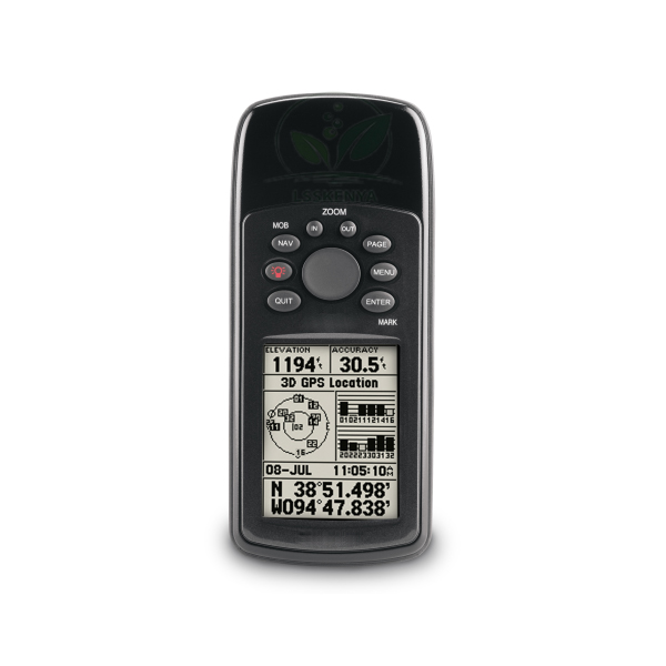
GPS Receiver, Basic (SKU LSK-CE-11319) is an entry-level satellite navigation receiver for field operations that stores up to 500 named waypoints, 50 reversible routes and 2,048 track log points, shows them on a 4-level grey LCD and runs up to 18 hours on two AA batteries. It suits geography and surveying fieldwork as well as field teams. Science Lab Supplies quotes the receiver from Ambala, India, for colleges, training centres, project teams and distributors.
Specifications
Memory, display, interfaces and power for the basic GPS unit are set out in the table. Briefly, it holds 500 waypoints, 50 routes of up to 250 points and 10 saved tracks, has a 41 x 56 mm LCD of 120 x 160 pixels, connects by USB or RS232, and takes two AA cells.
| Specification | Value |
|---|---|
| SKU | LSK-CE-11319 |
| Type | Basic GPS receiver suitable for field operations |
| Waypoints | Up to 500 waypoints/icons, with name and graphic symbols |
| Routes | 50 reversible routes |
| Points per route | Up to 250 |
| Track log | 2,048 track log points |
| Saved tracks | 10 |
| Display size | 41 x 56 mm |
| Display type | 4-level grey LCD |
| Display resolution | 120 x 160 pixels |
| Interfaces | USB, RS232 (serial) |
| Power | 2 x AA batteries (not included) |
| Battery life | Up to 18 hours |
| Supplied by | Science Lab Supplies, Ambala, India |
Applications and Experiments for the Basic GPS Receiver
The receiver fixes its position from satellites, then lets the user mark waypoints, follow a stored route or retrace a recorded track. With 500 waypoints, 50 routes and up to 18 hours on two AA cells, it covers a full field day of mapping, survey reconnaissance or navigation training.
- Class 11–12 geography fieldwork: recording waypoints of local features and plotting them on a map back in class.
- Surveying diplomas and ITI Surveyor trade: comparing GPS bearings with a Compass whose needle is mounted in an aluminium case with glass top.
- Introducing direction finding with a Compass with a red-tipped north needle before students move on to satellite positioning.
- Logging tracks for field projects and downloading them to a PC over USB or RS232.
Standard Scope of Supply
The GPS receiver is supplied as one unit with its USB and RS232 interfaces; the two AA batteries it needs are not included. Map software, spare batteries or compasses can be added to the same quotation if you are equipping a whole field group.
Packing, MOQ and Lead Time
Quotes are available for a single receiver or a set for every fieldwork group. Science Lab Supplies confirms the packing, delivery time and price for the quantity stated, and map software for the receivers can be priced on the same quotation.
Science Lab Supplies has an Importer-Exporter Code and can ship to buyers in Bangladesh, Zambia, Rwanda, South Africa, Qatar and Sri Lanka. Request a price on the contact page, line up receivers in the enquiry cart, or turn to the lab tender page for a formal tender.
Frequently Asked Questions
How many waypoints and routes can it store?
It stores up to 500 waypoints or icons with names and graphic symbols, and 50 reversible routes of up to 250 points each. The track log holds 2,048 points, with 10 saved tracks.
What batteries does it use, and how long do they last?
It runs on two AA batteries, which are not included, and gives up to 18 hours of use. Carry spare cells on long field days so recording is not interrupted.
Can data be moved to a computer?
Yes. The receiver has USB and RS232 serial interfaces, so waypoints, routes and tracks can be transferred between the unit and a PC for planning or analysis.
Who supplies the GPS Receiver, Basic?
Orders for this receiver are handled by Science Lab Supplies, a supplier in Ambala, India. The quotation it sends combines the receivers with any software or accessories and explains the packing and dispatch route.
Related GPS, Radio and Field Equipment
These products extend a basic receiver into a field kit, adding map data, GPS-enabled and two-way radios, lighting and technician tools. Each can be quoted together with the receiver for a fieldwork or project team.
- Map software for GPS receiver — worldwide base-map CD-ROM uploaded via microSD card or USB.
- Radio Manpack Kit — ruggedised, immersible HF radio with GPS and integrated ALE.
- Portable Radio Kit — 255-channel radio, switchable between 1 and 5 W.
- Solar Lamp with Phone Charger — three-LED lamp with 360–90 degree light distribution.
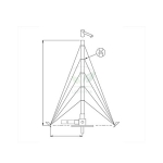
- Portable Antenna Aluminium, 12m — mast kit reaching 12 m when pulled out.
- Tool Kit, f. ICT Technicians, 220 VAC Eqpt — flashlights, compass and inclinometer among its tools.
- Tool Kit, f. ICT Technicians, 110 VAC Eqpt — electrical and battery drills with drill bits.
Browse the full Communication Equipment range, the Physics Lab range for compasses, or all School Lab Equipments.
Last updated: 22 October 2026